Flash flood watch posted for area as potential heavy rains could hit parts of Virginia today
Published 1:31 pm Wednesday, August 10, 2022

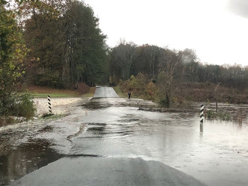
- A flash flood watch has been issued for Franklin, Southampton County and the Western Tidewater region Wednesday (File photo)
|
Getting your Trinity Audio player ready...
|
The National Weather Service office in Wakefield has issued a flood watch for Franklin and Southampton County, along with central, east central, eastern, north central, south central and southeast Virginia.
The flood watch begins at 2 p.m., Wednesday, Aug. 10 and continues through the evening hours. The NWS advisory said flash flooding is possible due to excessive rainfall that could materialize in the region.
Excessive runoff may result in flooding of rivers, creeks, streams, and other low-lying and flood-prone locations as the city sees a chance of showers and thunderstorms between 2-5 p.m. this afternoon, followed by the possibility of showers and a thunderstorm after 5 p.m.
The NWS forecast for Franklin states some storms could produce heavy rainfall. Chance of rain Wednesday is 60%, as the weather service calls for temperatures near 94 today with heat index values as high as 102 degrees.
The NWS advisory states that slow moving thunderstorms will develop this afternoon ahead of a cold front across the middle Atlantic. Some of the storms may drop very heavy rainfall in a short period of time. In the heaviest of rainfall, the weather service said 2-4 inches of rain could fall in an hour or two leading to flash flooding.
For precautionary and preparedness information, NWS advises residents to visit www.weather.gov/safety/flood.
“You should monitor later forecasts and be prepared to take action should flash flood warnings be issued,” the NWS advisory states.


